Log in
All resources
Create a design
2,977 Free Artworks of City Map
bibliothèque nationale de france
civitates orbis terrarum. urbium praecipuarum totius mundi. liber quartus
drawing
digital library of university of wroclaw
frans hogenberg
maps in the rijksmuseum amsterdam
maps in the stadsarchief amsterdam
hendrik de leth
daniël veelwaard (i)
daniël veelwaard
old maps of nagasaki
guillaume dheulland
maps of bremen
maps of weser
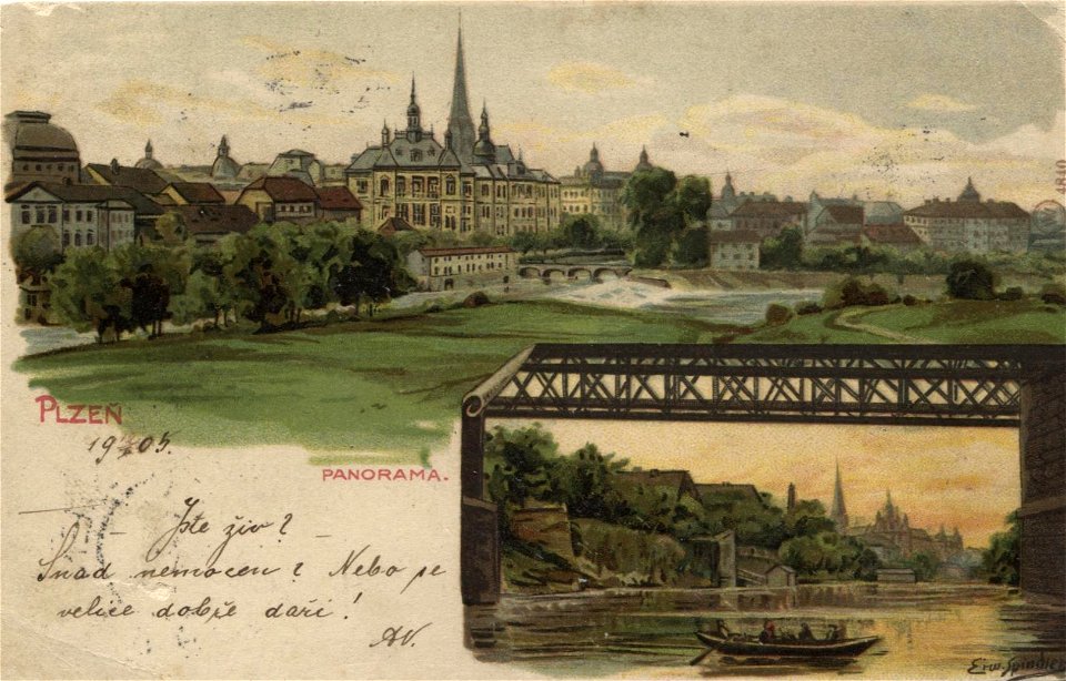
postcards by erwin spindler
postcards of plzeň
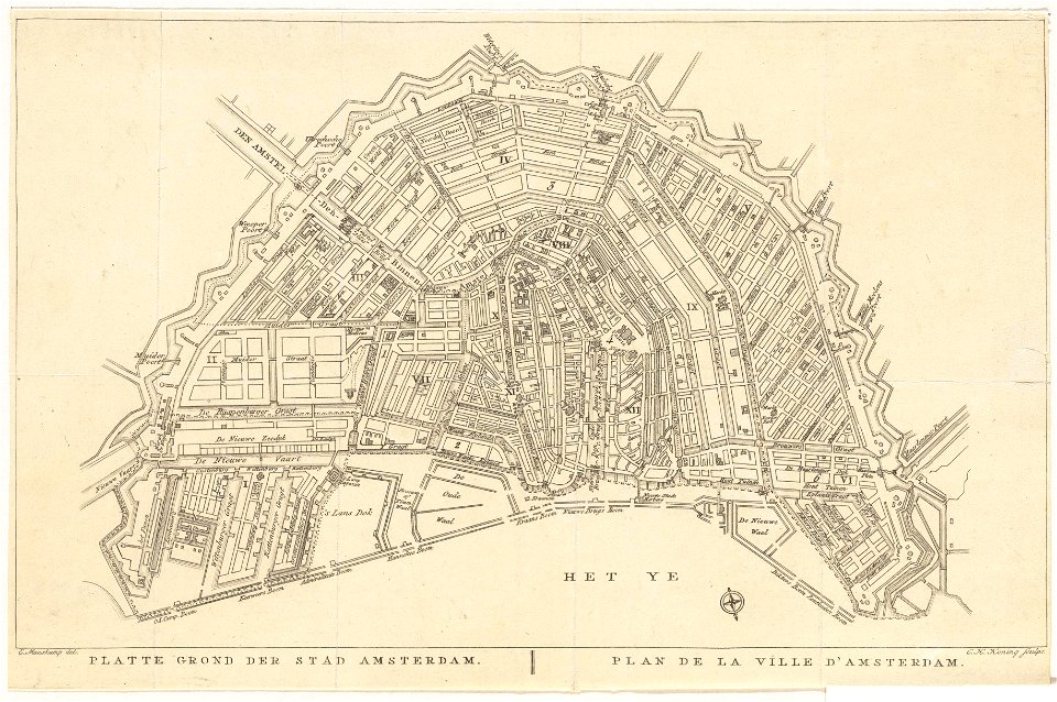
maps in the stadsarchief amsterdam
daniël veelwaard (i)
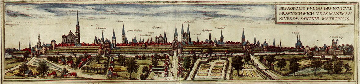
maps of braunschweig by braun & hogenberg
frans hogenberg
maps in the stadsarchief amsterdam
hendrik de leth
colored copperplate engraving
asia noviter delineata
het zegepralent kennemerlant
hendrik de leth
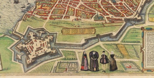
maps of antwerp by braun & hogenberg
maps of antwerp city walls
atlas schoemaker-noord-holland
old maps of beverwijk
valenciennes in the 1900s
postcards of valenciennes
old maps of amsterdam
evert maaskamp
utrecht (city) in the 17th century
joost cornelisz. droochsloot
english-language books about london
old maps of the city of london
1642 maps
baroque
civitates orbis terrarum. urbium praecipuarum totius mundi. liber quartus
maps of uraniborg on ven by braun & hogenberg
civitates orbis terrarum. urbium praecipuarum totius mundi. liber quartus
maps of bad segeberg by braun & hogenberg
civitates orbis terrarum. urbium praecipuarum totius mundi. liber quartus
maps of ostia antica by braun & hogenberg
civitates orbis terrarum. urbium praecipuarum totius mundi. liber quartus
maps of munich by joris hoefnagel
civitates orbis terrarum. urbium praecipuarum totius mundi. liber quartus
maps of bergen (norway) by braun & hogenberg
civitates orbis terrarum. urbium praecipuarum totius mundi. liber quartus
maps of saint-omer by braun & hogenberg
civitates orbis terrarum. urbium praecipuarum totius mundi. liber quartus
ierusalem, et suburbia eius maps by braun & hogenberg
civitates orbis terrarum. urbium praecipuarum totius mundi. liber quartus
maps of hann. münden by braun & hogenberg
civitates orbis terrarum. urbium praecipuarum totius mundi. liber quartus
maps of 's-hertogenbosch by braun & hogenberg
maps in the library of congress
1639 maps of cuba
life of christ (barberini tapestries)
old maps of the holy land
maps of paris by braun & hogenberg
bibliothèque nationale de france
17th-century maps of vienna
dancker danckerts
maps of schwäbisch hall by braun & hogenberg
bibliothèque nationale de france
maps of halberstadt by braun & hogenberg
maps of quedlinburg by braun & hogenberg
maps of moers by johannes mercator
bibliothèque nationale de france
maps of formia by braun & hogenberg
bibliothèque nationale de france
maps of haarlem by braun & hogenberg
bibliothèque nationale de france
maps of st. gallen by braun & hogenberg
maps of konstanz by braun & hogenberg
bern city map of 1638 by matthäus merian
baroque
bibliothèque nationale de france
dheulland map of paris
bibliothèque nationale de france
dheulland map of paris
maps from gallica
guides joanne
prints by cornelis anthonisz. in the rijksmuseum amsterdam
map of amsterdam, 1544
second unitarian church of new york
etchings of new york city
beschreibung und contrafactur der vornembster stät der welt, liber primus civitates orbis terrarum
maps of mexico city by braun & hogenberg
maps of country estates in the netherlands
het zegepralent kennemerlant
drawings in hcl (maastricht)
maastricht in the 1820s
historic views of speyer
wilhelm besserer
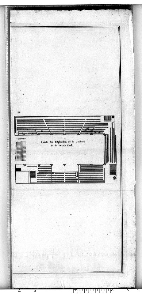
construction drawings in the stadsarchief amsterdam
daniel stoopendaal
backs of postcards in curt teich postcard archives
postcards of oklahoma city
frankfurt-altstadt
baroque
exposition le maire et l'architecte (lyon, 2019)
le plan de la ville, cité, université fauxbourg de paris by melchior tavernier
maps of paris from bibliothèque nationale de france
bibliothèque municipale de valenciennes estampes
pierre aveline
maps of ports and fortresses of the mediterranean by marco boschini (1651)
old maps of heraklion
maps of paris by braun & hogenberg
bibliothèque nationale de france
maps of bergen op zoom by braun & hogenberg
atlas beudeker
maps of kortrijk city walls
history of kortrijk
old images of goa
anno salutis
print room of the university of antwerp
maps of antwerp by braun & hogenberg
old maps of nijmegen
hendrik feltman
prints published by pieter van der aa
nieuwe cronyk van zeeland
prints by frans hogenberg in the rijksmuseum amsterdam
maps in the rijksmuseum amsterdam
prints by frans hogenberg in the rijksmuseum amsterdam
maps in the rijksmuseum amsterdam
maps of bremen by braun & hogenberg
popinjays in germany
historical images of bieraście
erik dahlbergh
drawings in the stadsarchief amsterdam
haringpakkerstoren
pompeiana - the topography, edifices, and ornaments of pompeii (1817)
maps of pompeii
maps of the county of mark
guillaume sanson
old maps of kraków
pierre aveline
maps of cairo by braun & hogenberg
bibliothèque nationale de france
maps of bar-le-duc by braun & hogenberg
bibliothèque nationale de france
maps in the rijksmuseum amsterdam
maps by pieter mortier
17th-century paintings in the amsterdam museum
paintings by pieter isaacsz
fonds ancely - bibliothèque municipale de toulouse - maps
19th-century maps of calvados
atlas schoemaker-overijssel
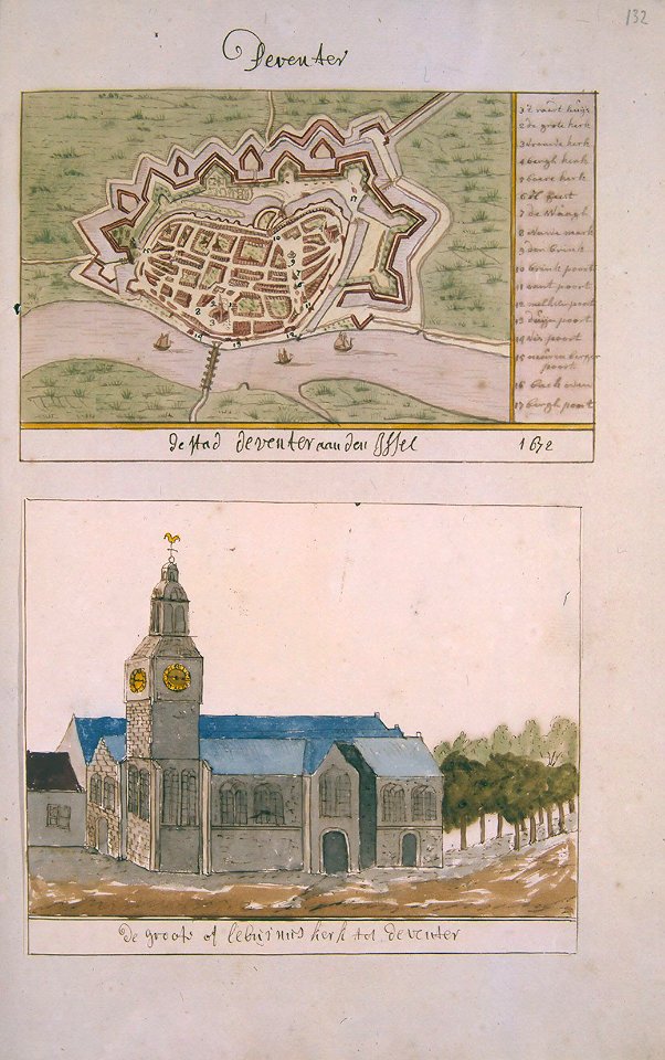
history of deventer
the custom house, dublin (1707)
1766 fleurons
the custom house, dublin (1707)
1766 fleurons
old maps of valletta
joan blaeu
bruxella nobilissima brabantiae civitas an° 1640
domus isabellae
construction drawings in the stadsarchief amsterdam
daniel stoopendaal
maps of bourges by braun & hogenberg
maps of orléans by joris hoefnagel
maps of dordrecht by braun & hogenberg
bibliothèque nationale de france
maps of budapest by braun & hogenberg
maps of vienna by braun & hogenberg
maps in the stadsarchief amsterdam
daniël veelwaard (i)
maps in the rijksmuseum amsterdam
maps of pompeii
maps of exeter by braun & hogenberg
floyer hayes, exeter
maps of exeter by braun & hogenberg
floyer hayes, exeter
maps from the earth and its inhabitants, vol. iii
old city maps of munich
pompeiana - the topography, edifices, and ornaments of pompeii (1817)
house of sallustius (pompeii)
maps in the rijksmuseum amsterdam
18th-century maps of gibraltar
maps in the stadsarchief amsterdam
claes jansz. visscher (ii)
maps in the stadsarchief amsterdam
daniël veelwaard (i)
maps of burgos by braun & hogenberg
1645 in spain
civitates orbis terrarvm, liber primvs (1577)
maps of mexico city by braun & hogenberg
maps of bar-le-duc by braun & hogenberg
historical images of bar-le-duc
old maps of rhodes (city)
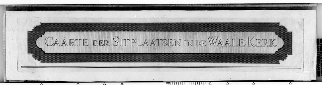
thesaurus philopoliticus
het zegepralent kennemerlant
hendrik de leth
maps of agnano and grotta del cane by braun & hogenberg
bibliothèque nationale de france
maps in the library of congress
old maps of veracruz (city)
juan francisco leonardo (1687) mapa del arzobispado de toledo
1680s maps of spain
collection cartographic documents from het utrechts archief
prints by jan van vianen
maps of haguenau
carolus allard
die kunstdenkmäler von stadt und dom brandenburg (1912)
maps of brandenburg an der havel
1701 - 1800 of 2,977
Next page
/ 30